
Cape Reinga
The northernmost tip of New Zealand, where the Pacific Ocean and Tasman Sea meet. It holds cultural significance for the Maori people.
Te Araroa (The Long Pathway) is New Zealand's long distance tramping route, stretching circa 3,000 kilometres (1,900 mi) along the length of the country's two main islands from Cape Reinga to Bluff.
Use this journey to visualize collective, individual, or team progress. Set any goal and MoveZenGo scales the route to match it.
Participants unlock these milestone badges during the challenge. Each milestone can trigger a personalized email with more information about the location.
The northernmost tip of New Zealand, where the Pacific Ocean and Tasman Sea meet. It holds cultural significance for the Maori people.

A stunning and seemingly endless stretch of golden sand that serves as part of the trail, offering a unique coastal experience.

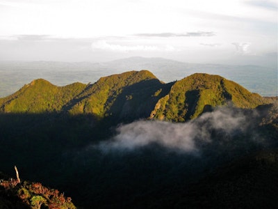
Pirongia Mountain is a distinctive landmark 25km southwest of Hamilton. Pirongia is an ancient volcano. Its dramatic skyline and dark green forests contrast with the surrounding farmland. It offers extensive views of the Waikato Basin across the Kaimai Ranges.

Home to the iconic Tongariro Alpine Crossing with breathtaking volcanic landscapes.

A canoe or kayak adventure along the Whanganui River, offering a different perspective of New Zealand's landscape and culture.

A challenging and rewarding section with stunning alpine scenery and panoramic views of the surrounding landscapes.

Surrounded by New Zealand's highest peaks, offering spectacular alpine scenery.

Home to some of New Zealand's most famous fiords, including Milford Sound and Doubtful Sound, providing awe-inspiring natural beauty.

The southern terminus of the Te Araroa Trail, located in Bluff, offering a sense of accomplishment and completion for hikers.
Create your personalized fitness challenge within minutes.